

Planning a trip to San Francisco?
Foursquare can help you find the best places to go to.
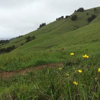
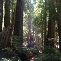
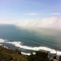
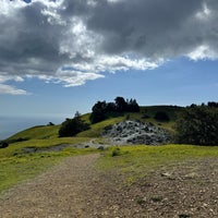
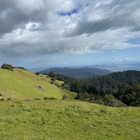
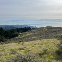
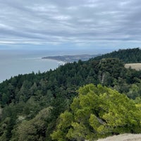
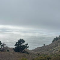
Mount Tamalpais State Park
State or Provincial Park, Hiking Trail, and Mountain
Mill Valley

 "Great hikes to Muir Woods and Stinson Beach"(3 Tips)
 "What a view💖😘💥 having a fun adventure with these girls😉"(10 Tips)
 "lots of trail options of various difficulties."(2 Tips)
 "picnic table by the meadow"(2 Tips)
Filter:
- hiking
- scenic views
- trails
- stinson beach
- wild turkey
- (12 more)
Sort:
- Popular
- Recent
 Nathaniel BoltonOctober 14, 2013Get the picnic table by the meadow for some of the best wild turkey watching outside the city. Service is non-existent, we waiting for hours and nobody came to our table.
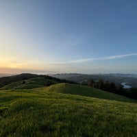
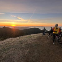
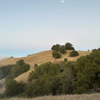
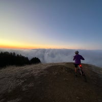
 Pei 👻 WenJanuary 23, 2017Mt Tam never fails. Beach, panoramic views, single track trails, creek, roots, sunrise and sunset. You name it.
 Upvoted Feb 11
 RootsRatedDecember 19, 2013The legend is that mountain biking, itself, was born on the slopes of Mt. Tam. fifty years ago bombing down the trails on hand-wrenched reclamations of old Schwinn cruisers via rootsrated.com Read more
 Juston PayneFebruary 10, 2013The views are unbelievable on clear days. A great, 3-hour hike starts at the Pantoll Rd. & Ridgecrest Blvd and goes: Old Mine Trail > Matt Davis > Coastal > Cataract. Here's a trail map: Read more
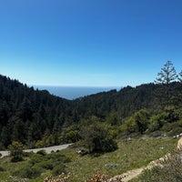
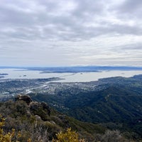
 TerraTopiaAugust 16, 2011Gorgeous views. Lots of trails. Take a picnic or check our the Mountain Home Inn for lunch overlooking the hills, the Bay and the local towns. Read more
 Ramon SimmsMarch 10, 2013park across from Mountain Home Inn. head north up the fire station exit. go left on the dirt trail, pass: station and silo to see trail signs. download a map tho, signs are few and confusing.
 JuneAugust 6, 20136.7 mile loop hike is moderate. Mix of sun and shade/ Trail surfaces: Dirt fire roads and trails/ 3 1/2 hours. From http://www.bahiker.com/
 Nick FruendtApril 14, 2014Beautiful views and lovely nature spots! Matt Davis trail to steep ravine from Stinson Beach. Bahiker.com
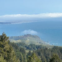
 Emily CJune 10, 2013REALLY great views of coast on Matt Davis & Steep Ravine Loop. 7.5 mile RT w/ high incline: Firehouse at Stinson Beach -> Matt Davis Trail -> Pan Toll Station -> Steep Ravine -> Dipsea -> Firehouse
 Shalin PeiJune 9, 2013Short and rocky hike to the peak. Really hot since it's above the cloud line. Make sure the dogs don't overheat
 ToryBurchMay 6, 2011There are hundreds of miles of great trails here. On rainy days, take a drive through the beautiful, misty forest.


 Run Yolanda Trail. From Phoenix Lake to Worn Springs, then up to Bald and back down. Killer run. Read more


Foursquare © 2024 Lovingly made in NYC, CHI, SEA & LA
None listed (See when people check in)
People tend to check in during these times:
- Today
- None
- Wed–Thu
- None
- Fri
- Noon–1:00 PM
- 8:00 PM–9:00 PM
- Sat
- 9:00 AM–9:00 PM
- Sun
- 8:00 AM–8:00 PM
- Mon
- 10:00 AM–11:00 AM
- 1:00 PM–4:00 PM
(415) 388-2070
See More
Places inside Mount Tamalpais State Park
- 9.3

"A challenging but very fun hike! One of the only hikes where you go through such vastly different terrain"
 Annie Tang
 - 9.4

"Great views! Some paved paths, some rocky steep paths. Great spot to have lunch and a hike. Flush toilets too! 😀"
 Meg
Meg - 9.5

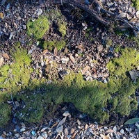
"Steep Ravine hike is great. Lush forests with beautiful moss. The views are wonderful and on a clear day you can see all the way to SF."
 Adena Brenowitz
You might also like


Places people like to go after Mount Tamalpais State Park


Appears on 272 lists

Created by Natalie Lin
138 items • 52 followers
Best Running and Hiking Trails
Created by Annamarie
39 items • 30 followersCreated by Vincent Tang
59 items • 16 followers